Saturday, October 31, 2009

Petrified Forest National Park - Arizona

Today we visited the Petrified Forest National Park. Portions of the park are within the Painted Desert. We watched the orientation video at the Visitor Center, then headed out for the 28-mile scenic park road. The first part of the road passes through portions of the Painted Desert. We stopped along the way to visit the Painted Desert Inn, built in the early 1900's, for early visitors to the area. It was later taken over by the park service and remodeled by the Civilian Conservation Corp. During part of its tenure, it was managed by the Fred Harvey Company for the National Park Service.


Snow from a couple of days ago.

Historic Painted Desert Inn

Painted murals inside the Inn.

A section of the park known as Puerco Pueblo contains remnants of an old 100-room pueblo built around 1250 AD and house nearly 1,200 people. There are a number of large boulders that contain petroglyphs.


We did not get a early start this morning, so we opted to skip the remainder of the drive and find a place to have lunch. Oh, where are the pictures of the petrified wood? Once you seen one, you have seen them all.

Thursday, October 29, 2009

Brrrrr - Bluff, Utah

We decided to stay another day in Bluff due to some white stuff we, as full-time rv'ers, are supposed to avoid. We plan to leave tomorrow and head south to Sun Valley, Arizona.

Tuesday, October 27, 2009

Valley of the Gods - Utah

Due to the weather forecast for the next couple of days, today would probably be our last site-seeing day. We started the day with a drive through the Valley of the Gods. It is know as a "Mini-Monument Valley". The road was a very nice, graded road (4x4 not needed). There were no more maps at the self-service entrance station, so we were not sure of the formation name...so we named them ourselves. At the end, there was a posted map and we had guessed correctly on a couple of the formation names.


Battleship Rock

Finding a geocache (Castle Butte in the background)

After the above picture was taken, my Canon Powershot S2IS camera "gave up the ghost". The lens would not retract and the camera would shut down with an error code. When we returned to the rig, I tried to fix it. I was able to get the camera to retract the lens, but after a couple of on/off cycles, the camera failed again. I guess I need to look for a new camera?

Moki Dugway & Muley Point - Bluff, Utah

The road through the Valley of the Gods exits onto Utah Route 261, also known as the Moki Dugway. It was constructed in 1958 by Texas Zinc, a mining company, to transport uranium ore from the "Happy Jack" mine in Fry Canyon, UT. to the processing mill in Mexican Hat. The three miles of unpaved, but well graded, switchbacks ascends 1100 feet to the top of Cedar Mesa. The State of Utah recommends that only vehicles less than 28 feet in length and 10,000 pounds in weight attempt to negotiate this steep (10% grade), narrow and winding road.

The switchbacks of Moki Dugway
At the top of the dugway, we took another graded dirt road to Muley Point. From Muley Point, you can see the San Juan River "meanders" and in the far distance, Monument Valley. We took a few pictures, had a picnic lunch and found a geocache. We drove a short distance to find another geocache. We searched for at least twenty minutes to no avail. We believe that cache was gone.

View of the San Juan River "meanders"


Monument Valley on the horizon

At Muley Point

Natural Bridges National Monument - Utah

After leaving Muley Point, we continued north on the Moki Dugway, towards Natural Bridges National Monument. On the way, we stopped at one geocache. It had a very unusual cache container (in Y's hand).


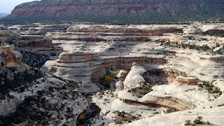
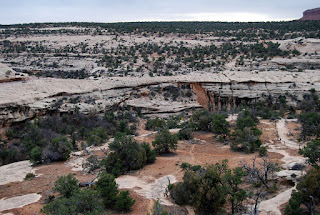
By the time we arrived, the temperature had dropped and the wind was gusting. The weather made for a quick "get out and take a photo" drive. The bridges are carved by rivers flowing on both sides of a thin wall of sandstone, until the water wears through and creates a new course for the river. The bridges blend in well with their surrounding, so click on the images to view full-size.

Sipapu Bridge

Kachina Bridge

Owachomo Bridge

Rick at Owachomo Bridge

Monday, October 26, 2009

Monument Valley - UT/AZ Border

Today we drove down to Monument Valley on the Utah/Arizona border. On the way, we stopped at the location where Forrest Gump ended (in the movie) his three-year run across the country.

Monument Valley is famous for the setting of numerous movies, including several John Wayne westerns. The valley is on Navajo Nation land, so national park passes are not accepted. Admission was $5 per person. A number of guided Jeep tours were available for an extra charge, but we opted for the 17-mile scenic loop drive in our own Jeep.

After driving the loop, we decided to eat at the monument restaurant. John and I had the Green Chili Stew...boy was it a good choice!

Forrest Gump movie location.

The Three Mittens from the restaurant balcony.

The Three Mittens (the most photographed of the monuments).

Camel Rock

A cute couple.

The Window

Hardy survivor in view of the West Mitten.

Geocaching at Mexican Hat - Mexican Hat, Utah

On the way back from Monument Valley, we stopped at Mexican Hat Rock (the town of Mexican Hat's namesake) to do some geocaching.


That's John and I climbing the hill looking for a cache. The girls stayed behind, due to the possibility of snakes and other critters. We were allowed to go because our life insurance policies were paid up!

John finding the second cache.

Goosenecks State Park - Utah

Goosenecks State Park is one of the smallest parks we have visited. It is comprised of an overlook, and a few picnic tables. The overlook provides a view of the San Juan River as it meanders towards the Colorado River and Lake Powell. Over the years, the San Juan River has cut huge canyons through the sandstone that has created these narrow (gooseneck-like) peninsulas. The view was awe-inspiring!

Saturday, October 24, 2009

Four Corners - AZ, CO, NM, UT

This morning we drove over to Four Corners, where the borders of Utah, Colorado, Arizona, and New Mexico come together. There is not much to see, other than the monument and a few Native American vendors.


The four of us...standing in different states.

Y, doing the four-state shuffle.

Lounging in four states at once.

Hovenweep National Monument - Utah

After our stop at Four Corners, we drove over to the Hovenweep National Monument. The towers of Hovenweep were built by Ancestral Puebloans between 1200 and 1300 A.D. It was amazing, that so much of the buildings are still standing after 700 years. We took the hike around the canyon to get a better view of the buildings.


During our picnic lunch break, a Scrub Jay stopped by for a snack. We placed nuts on the table and the jay would snatch them and fly off to an unseen nest. He continued to return until we ran out of nuts.

Friday, October 23, 2009

Fort Bluff Historical Renovation Site - Bluff, Utah

Today we toured the Fort Bluff Historic Site. This area was settled by a Mormon expedition that started from Escalante, Utah and ended here in 1880. The settlers had to endure numerous hardships, including passing down a small crevice into the Colorado River gorge near was is today, Lake Powell. This passage is known today as the Hold In the Rock. A group of volunteers are restoring the fort, including constructing new cabins.


The only remaining original cabin.

A shot from a cemetery overlook above the town. Many of the descendants of the settlers are buried here.

The Navajo Twins rock formation (above a local restaurant and trading post).

Thursday, October 22, 2009

Cottonwood RV Park - Bluff, Utah

Today we left Moab after two weeks and headed south, to Bluff Utah (about 100 miles). We pulled into Cottonwood RV Park for a week. The park has large, pull-thru sites and plenty of room. We have a great view of the mesa that surrounds the area. The park is centrally-located for visiting several sites in the four-corners area.


We drove around the town to check out the local sites. We found an old kiva and cemetery on the hill overlooking the town. We found two geocaches in the area. We also stopped for a third geocache next to Fort Bluff, a local restoration project. We plan to visit the fort tomorrow. We stopped at the local steakhouse for dinner, then back to the rig for some cards and site-seeing planning.

Wednesday, October 21, 2009

Canyonlands National Park - Moab, Utah

Today we visited the Islands in the Sky section of Canyonlands National Park. There are several overlooks that provide views of the canyons below, including the Colorado and Green Rivers. Off in the distance were the La Sal Mountains that had already received some snow.

We took the short hike to Mesa Arch which provided a vista to view Shafer Canyon. This canyon is know for its steep switchbacks that lead to a trail at the base.

This is our last day, of our two-week stay, in Moab. We enjoyed our time here and hope to return some day.
Tomorrow, we head further south.

At Mesa Arch

La Sal Mountains (snow-capped) from Mesa Arch


Views of Shafer Canyon