The Yellowstone Lake area begins at 47 miles into the park. Our first stop was Indian Pond which was created when hydrothermal pressure reached critical mass and blew its top, much like a volcano except with water and steam. The pond is the result. While there we saw some bison grazing at the far right of the pond.

Our next stop was Fishing Bridge which is a cutthroat trout spawning area. Up until the early '70s, people were able to fish from the bridge, hence the name. Due to a decreased number of trout the practice was stopped and now you just observe the trout.

Our next stop was the Hayden Valley...known for having an abundance of wildlife. The only thing we saw was a couple of bison in the far distance and on our return trip (more on that later) we saw a coyote.

By now it was 3:00pm and we were getting hungry. We stopped at the Otter Creek Picnic Area for lunch.

Next we drove into the Canyon area of the park. This area includes the Upper and Lower Falls, and the Grand Canyon of the Yellowstone. The Upper Falls are 109 feet high and the Lower Falls are 308 feet high.
Rick at the Upper Falls Lookout on the South Rim Trail.
A black-white shot of the Lower Falls from Artist Point.
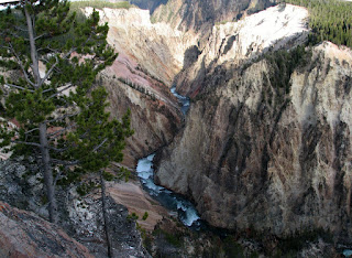
The yellow in the walls of the canyon is where the park gets its name.

A black-white shot of the Lower Falls from Artist Point.

The yellow in the walls of the canyon is where the park gets its name.

The Grand Canyon of the Yellowstone from the Grand View lookout.

Earlier, I alluded to the return trip. In the middle of August, the park closed a section of the Grand Loop Road. That meant instead of a 40 mile trip back to the West Entrance, it was an 84 mile backtrack trip. It took 2 1/2 hours to exit the park (8:30pm). It was dark the last 30 minutes of the trip and there were several times we had to stop for animals (bison, elk and deer) on the road. It was a long, but enjoyable day!
Sunset of Yellowstone Lake (sunset from behind)
